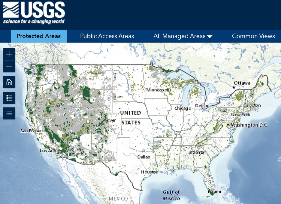
The Protected Areas Database (PAD-US ) is the official national inventory of U.S. terrestrial and marine protected areas that are dedicated to the preservation of biological diversity and to other natural, recreation and cultural uses, and managed for these purposes through legal or other effective means. Lands in PAD-US are mainly owned in fee by public agencies and nonprofits.
PAD-US includes a total of 60,891 units greater than 1 square kilometer (247 acres), including fee ownership, designations and conservation easements. Each unit has a named manager – either a federal, state, regional, or local agency or private conservation organization. Most units are clearly defined and managed sites (e.g. parks, refuges, grazing allotments, wilderness areas). Open the USGS Public Lands Map Viewer to see all public lands.
PAD also includes administrative entities. These large administrative areas were included for the purpose of assessing overall conservation outcomes in the lower 48 states, but were excluded for the the place-based Last Great Places analysis.
• Entire National Forest administrative areas are tallied in PAD-US as “units,” even though they are typically very large, often sprawling or dispersed management assemblages. For example, “National Forests in North Carolina” is considered a single unit, even though this unit is comprised of four distinct National Forests ranging across the state from the coast to the mountains which total ~1.2 million acres.
• Bureau of Land Management administrative field office entities are responsible for managing large and dispersed expanses of lands; 140 BLM offices collectively managing over 170 million acres are tallied as single units. State Trust lands sprawling across the west (totaling over 40 million acres) are often tallied in PAD as a single unit for each given state, even though they include many small, widely-dispersed lands based upon one square mile sections. Similarly, vast Tribal managed areas were also excluded for the purpose of evaluation places.
On the other hand, over 29,000 designated places totaling over 400 million acres within these Forest Service and BLM administrative regions are also inventoried — including Wilderness Areas, Wilderness Study Areas, Inventoried Roadless Areas, Research Natural Areas, Areas of Critical Environmental Concern, Wildlife Management Areas, Grazing Allotments and other designations. The largest of these designated areas is the Frank Church River of No return Wilderness in Idaho at over 2.3 million acres.
Areas smaller than 1 square kilometer (247 acres) were excluded for Last Great Places analysis. Over 50,000 PA units in the database were evaluated.
Note: Last Great Places used Protected Areas Database (PAD-US) 2.0. Much analysis for this project was done prior to the release of PAD 2.1 in late 2020, which added 75,000 local parks and nearly 5,000 local land trust areas – mostly smaller sites.